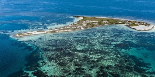
Ningaloo Coast
The State Government is creating conservation and recreation reserves along the spectacular Ningaloo Coast to ensure that this area is protected and remains accessible to the public now and for future generations.
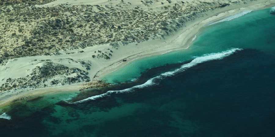
Where else in the world can you camp along the coastline, with an outstanding marine park in a World Heritage area on your doorstep, stunning coral reef metres from the shore, and the opportunity to get away from it all?
The Ningaloo coastal reserves will be created over the coastal strip of unallocated Crown land adjacent to Ningaloo Marine Park, where many people enjoy low key recreation each year. It also includes State lands that were taken out of pastoral leases in 2015. It is a key part of Plan for Our Parks, which aims to create five million hectares of new national and marine parks and reserves across Western Australia.
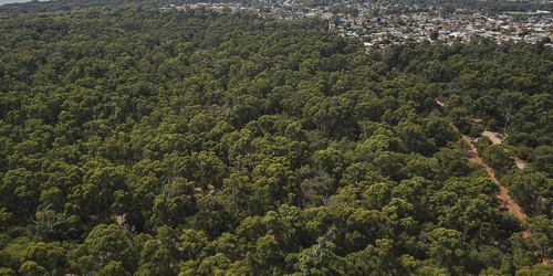
The Ningaloo Coast is part of the Baiyungu, Yinikurtira and Thalanyji peoples' traditional land and sea country and maintains significant cultural values.
Draft joint management plan
The Nyinggulu (Ningaloo) coastal reserves joint management plan provides direction for the joint management between the Department of Biodiversity, Conservation and Attractions (DBCA) and the Gnulli Native Title claimants of existing and proposed coastal conservation and recreation reserves along the Nyinggulu (Ningaloo) Coast over a 10-year period.
This includes:
- the terrestrial portion of Ningaloo Marine Park, an existing reserve 40m landward of high water mark north of Amherst Point
- land not renewed in the 2015 pastoral lease renewal process from Red Bluff in the south to Winderabandi in the north
- other portions of unallocated Crown land
The joint management plan aims to conserve and protect the values of the planning area in the long term. It provides a summary of operations proposed to be undertaken and the vision includes a desire to maintain a low-key recreation experience, welcoming and encouraging visitors to enjoy, understand and respect the cultural and natural values of the area.
The joint management plan is available on the Parks and Wildlife Service approved management plans page.
Find out more about:
Camping on the Ningaloo Coast (ex-Ningaloo station) – Proposed Nyinggulu Coastal Reserves (Campgrounds previously managed by Ningaloo Station)
Camping on the Warroora Coast – Proposed Nyinggulu Coastal Reserves (Campgrounds previously managed by Warroora Station)
Why are the proposed reserves being created?
The creation of the proposed reserves will enable conservation of the significant natural and cultural values along the Ningaloo coast, and importantly, provide ongoing access and recreational opportunities for all Western Australians and other visitors.
This area attracts many thousands of visitors each year who seek to camp against a backdrop of the world-famous Ningaloo Marine Park. The plan proposes to maintain affordable, remote and self-sufficient camping and caravanning experiences. Managing the area in partnership with traditional owners will have many benefits, not only for sharing knowledge and the enhanced protection and management of the Nyinggulu (Ningaloo) Coast but also in terms of job creation, connection to country and customary activities.
The creation of the proposed reserves will ensure that long-term public access to the coast continues and management of natural, cultural and recreational values is integrated with the management of the World Heritage-listed Ningaloo Marine Park.
Refer to Section 1 of the plan (pages 1 to 2) for a description of the planning area and why the reserves are being created.
Who will manage the public reserves?
The existing and proposed reserves will be managed under the Conservation and Land Management Act 1984 (CALM Act) and are proposed to be jointly managed by the department with the Gnulli Native Title claimants. This will also support Aboriginal employment and training opportunities. As part of the department’s commitment to joint management, Aboriginal rangers have already been employed on the coast and the Gnulli Native Title claimants are already being involved in on-ground management.
The existing and proposed reserves cover camping and day use areas from Red Bluff to Winderabandi but does not include the lease areas of Red Bluff, Quobba Homestead, 3 Mile Camp, Gnaraloo Homestead, Warroora Homestead, Coral Bay townsite or Bruboodjoo. These areas will continue to be managed by the relevant lessees or local government and are not part of this planning process other than being enclaves or adjacent lands to the planning area that provide additional recreational opportunities and experiences for visitors.
The State government will continue to offer opportunities for pastoralists to be involved in managing the coast through fee-for-service contracts and will work closely with pastoralists concerning cross boundary issues across enclave lease areas (Red Bluff, 3 Mile and Bruboodjoo) and adjacent pastoral leases (which provides tourism homestead and cabin accommodation).
Refer to Section 3 of the plan (pages 5 to 6) for more information on joint management.
What are the proposed reserves going to be?
In line with recommendations from successive governments dating back to the 1970s the new public reserves will be for conservation and recreation purposes. They will be included as part of the important network of conservation estate across Western Australia. Currently all of the proposed reserves are unallocated Crown land as they were not renewed as pastoral lease in 2015, or in some instances were already unallocated Crown land.
Part of the former Ningaloo Station will be part of the southern extension of Cape Range National Park and the remainder of the unallocated Crown land south to Red Bluff will be a CALM Act section 5(1)(h) reserve for the purpose of ‘conservation and recreation’.
The existing tenure of the terrestrial portion of Ningaloo Marine Park (40m landward of high water mark north of Amherst Point) on which a lot of recreation already occurs will not change. This coastal strip has been conservation estate since 1987 and will continue to be.
Refer to Appendix 1 of the plan (pages 109 to 111) for more information on the tenure of the planning area.
When will the reserves be created?
The State Government is negotiating an indigenous land use agreement with the Gnulli Native Title claimants, expected to be finalised by the end of the year that will ensure the creation of the reserves meets the requirements of the Commonwealth Native Title Act 1993.
Until the creation of the reserves, the land is being managed jointly by the department and Gnulli Native Title claimants as unallocated Crown land with a focus on ensuring visitor safety and maintaining the conservation values of the coast.
How will I be affected as a visitor to the Ningaloo Coast?
Low cost camping and the unique wilderness experience enjoyed by thousands of people each year will be retained through the establishment of the public reserves which will have the purpose of conservation and recreation.
Camping, surfing, fishing, diving, snorkelling and other forms of recreation will continue. Camping experiences will be improved through rehabilitation of degraded and eroded coastal areas, integrated feral animal and weed programs and improved waste management along the coast.
The department is already managing the existing terrestrial portion of Ningaloo Marine Park and rehabilitation works have commenced in areas such as Sandy Point, Five Fingers and other degraded sites along the coast.
Refer to People on Country in the plan (pages 64 to 94) for more information on recreation and tourism. Appendix 9 has more details on each of the camping and day use sites within the planning area and proposed works.
Will the experience be changed?
No. The ‘Ningaloo Experience’ will be maintained with specific strategies aimed at keeping the coast a unique yet sustainable experience in the longer term. For example, signage and rehabilitation works will be kept low key and minimal. At campgrounds such as Sandy Point, coir logs and coir matting are being trialled for defining camp site boundaries and rehabilitating sensitive areas. Using these types of materials provide a more natural approach to site delineation compared to other materials.
Refer to Section 19 of the plan (page 64) for more information on maintaining the ‘Ningaloo Experience’.
Will you be locking away areas?
The department and the Gnulli Native Title claimants will be managing the coast for everyone to visit and enjoy. Areas will not be ‘locked away’. In some instances, access will need to be managed to protect areas such as sensitive cultural sites, turtle and seabird breeding areas in order to preserve the values of the coast for future generations.
Will the Ningaloo Coast be opened up for development?
The draft joint management plan proposes that affordable low-key camping and caravanning along the coast will be maintained at current levels, with a key focus on continuing the current experience and the sense of remoteness and high level of self-sufficiency prized by visitors. Short to medium term management effort will be directed towards rehabilitating tracks and degraded areas around camping and day use areas while keeping development to a minimum, with no built accommodation proposed.
Refer to section 19 to 23 of the plan (pages 64 to 95) for information on managing recreation and tourism.
Are you going to seal any roads?
No, all current access managed by the department will remain as unsealed 4WD tracks. Some repair work will be required from time to time in order to protect the natural values and manage visitor risk.
Refer to Section 20 of the plan (pages 73 to 79) and maps 3A,B,C and D (pages 134 to 137) for more information on maintaining access within the planning area.
Can I still take my dog when I go camping?
Yes, you will still be able to take your dog camping along the coast and in order to allow this to continue, areas will need to be designated under the CALM Regulations. However, for example during turtle or seabird breeding seasons, some beaches may need to be kept dog-free.
Refer to Section 21 Action 40 (page 90) of the draft joint management plan.
Can I still have a campfire?
Yes, you will still be able to have campfires when camping. The plan proposes to provide fire rings or designate campfire sites to address visitor comments about campfire coals spreading around campsites ruining the amenity of the area and associated safety concerns. Firewood would still need to be brought into the reserves.
Refer to Section 21 Action 36 (page 90) of the draft joint management plan.
Will off-road vehicles/motorbikes/quad bikes be banned?
Private, unlicensed all-terrain vehicles/quad bikes (ATVs) and other off-road vehicles are currently not permitted in the existing reserves or the unallocated Crown land, and this will not change.
Vehicles licensed under the Road Traffic Act 1974 will be allowed on tracks within the planning area. Access to beaches by licensed vehicles at some sites for boat launching will continue, although driving along stretches of beach will not be permitted as per the management plan for the Marine Park.
Commercial ATV treks will be continually reviewed to ensure impacts on natural and cultural values are minimised.
Refer to sections 20, 21 and 22 of the plan (pages 76, 78, 79, 91 and 92) for more information on off-road vehicles.
How much will it cost to camp in the reserves?
Low cost camping will be retained along the coast. All fees will go directly back to managing the reserve and the adjacent Ningaloo Marine Park.
What consultation has already occurred?
A review has been undertaken of the extensive independent research already conducted along the Ningaloo coast, focussing on visitors’ expectations and the camping experiences they desire. Additional consultation with visitors has been undertaken through on-site interviews and a 2017 online visitor survey to further understand the types of visitor facilities people would like to see provided or upgraded along the coast and to validate the previous research. This information was used to inform the planning of the draft joint management plan.
Continual updates and meetings have been occurring with pastoralists, the Ningaloo Coast World Heritage Committee, local government shires, Coral Bay Progress Association and other stakeholders formally and informally during the draft joint management plan preparation phase by the local Exmouth District staff.
If you would like to meet to discuss any aspect of the plan please contact the Exmouth District office on (08) 9947 8000.
Refer to Section 19 of the plan (pages 68 and 69) for more information on previous visitor research and the 2017 visitor survey.
What will happen next?
Departmental staff and traditional owners are actively managing the Ningaloo Coast – undertaking operational works, responding to management issues and undertaking planning for the proposed reserves. This will continue to happen. Works that are currently being undertaken include rehabilitation of degraded areas, maintenance and repairs to tracks and trails, control of feral animals and weeds, establishment of flora and fauna recovery monitoring sites, protection and monitoring of cultural sites, installation of toilets and/or waste disposal facilities, public education programs and interpretive information. Submissions are now being considered by the Conservation and Parks Commission and the Gnulli Native Title claimants and the plan will be amended in light of all submissions received. The final joint management plan will then be prepared and gazetted and a summary of submissions will be made available along with the final management plan.