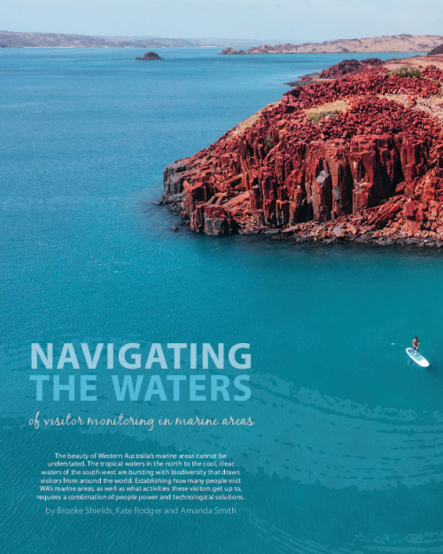
Western Australia has some of the most beautiful marine areas in the world. Visitors are drawn to these destinations to connect with nature, observe the diversity of animals and plants, and engage in activities such as snorkelling, boating, surfing and fishing. But how do researchers monitor who is doing what, what areas they’re visiting and what they value and enjoy about these places?
Scientists in the Visitor and Social Research Unit of WA’s Parks and Wildlife Service were funded through the Woodside Pluto Liquified Natural Gas (LNG) Project Offset D to identify and trial visitor-use monitoring methodologies and collection tools. The team headed to the Dampier Archipelago, located just off Karratha, approximately 1650 kilometres north of Perth.
One of the primary outcomes of the project was to identify a suite of monitoring methods that could be used to monitor visitors to the islands and surrounding waters with the view that these methods could be applied in other marine areas.
Marine areas are inherently difficult to monitor. They can have a multiple access points, both on the land and via the sea, so it’s not as easy as being able to count people as they enter a terrestrial park through an entry station. Data on visitor numbers and activities informs how visitation is changing over time and helps park managers identify where there may be visitor risk issues or where site upgrades may be required, including access points and information signs.
Among other purposes, understanding visitor numbers, and where and what those visitors are doing, informs park managers about how to better manage the area to ensure people get the right information and have an enjoyable visit.
 on the shore at the Dampier Archipelago. Photo – Amanda Smith/DBCA")
Sturt’s desert pea (Swainsona formosa) on the shore at the Dampier Archipelago. Photo – Amanda Smith/DBCA
Dampier Archipelago
The Dampier Archipelago is a stunning and unique part of the world with extensive Aboriginal culture and history, as well as having the richest marine biodiversity in Western Australia.
At the time the project began, 25 of the 41 islands were reserved for various reasons, mainly nature reserves, which provide habitat protection for turtles and seabirds. Camping is permitted on some beaches. The surrounding area is also an important industrial location for the State, with the Port of Dampier a major port for the export of iron ore, LNG and salt.
At the start of the project, researchers conducted a comprehensive literature review of available monitoring methods and technologies, some of which had historically been used in terrestrial settings but were able to be adapted to the marine environment.
The information that had already been collected by local staff was also reviewed, along with any other information that was available from other sources.
From there, a number of visitor monitoring methods were chosen to determine their applicability and useability for a marine setting including a recreational user survey.
Data were sourced from vehicle counters at key boat ramps and recreational fisher numbers using information from boat licence numbers for the local area. Bluetooth detection technology was also trialled at several locations across the State, which count the number of mobile phones within a certain area to give indicative visitation figures.
The recreational user survey was designed to map where people went and what activities they undertook (also known as public participatory geographic information systems or PPGIS). This survey provided a lot of useful information about what people were doing in the Dampier Archipelago including which islands they visited, how often they were visiting, what activities they were doing and where they were launching their boats.
As a result of the outcomes from the survey, PPGIS is being used more often in other marine areas as it provides spatial data that can be overlayed with other cultural and environmental values.
It is very resource-intensive, however, and the surveys can take a reasonable amount of time for users to complete, so these types of surveys need to be well considered and resourced to provide the right information to help inform the management of the area.

Dolphin Island and Flying Foam Passage, Dampier Archipelago. Photo – Rob Connell
People power
After trialling a suite of different monitoring methods in the Dampier Archipelago area and other locations across the State, it was discovered that collecting data on visitor use in marine areas often requires a combination of people power and technological solutions.
Using visitor-sourced methods, like surveys and interviews, researchers can get a lot of comprehensive information from marine area users, but these methods are resource-intensive.
Indirect monitoring methods also play an important role and use staff or equipment to count visitors or observe how they are moving through an area. These can include vehicle counters, bluetooth and other detection technologies, and booking systems for moorings, which provide indicative visitor numbers at specific sites and can be less resource intensive.
There are also direct monitoring techniques, such as aerial surveys or video monitoring, to explore visitor locations and activities but these may also be costly in staff time and other resources.
A decision on which visitor monitoring approaches to be used is a compromise between the need for accuracy, practicality and resourcing. Although some provide a lot of useful information, they may be extremely cost and resource intensive, so may not be possible or may have to be done more infrequently.

Conducting patrols in Lalang-gaddam Marine Park. Photo –Kate Rodger / DBCA
Remote Parks
Marine areas with direct access via beaches and boat ramps can be comparatively easier to monitor given their close proximity to access points, for example Marmion Marine Park near Perth or Ngari Capes Marine Park in the south west, although there may be multiple stakeholders that need to be engaged in their management such as local government authorities.
Some marine parks are remote and more difficult to access, and often have significantly lower visitation, which can make monitoring much more difficult.
The more remote the park, the more difficult and resource-intensive it is to monitor. It can also limit the number of options or equipment that can be used and may require researchers to spend significant periods of time aboard vessels while monitoring visitors.
Understanding visitor use
There are a variety of reasons why park managers need to know where people are going and what they’re doing in marine parks. As with all scientific monitoring programs, a systematic, targeted, repeatable approach is key and by integrating a variety of different monitoring techniques, visitor use patterns in marine parks can be more effectively monitored and understood.
The collection of data on visitor use in marine parks usually needs a combination of people power and technological solutions. It is often the physical locations and settings of sites, as well as the availability of resources, that determines what monitoring options are available.
Ultimately, marine parks are established to conserve biodiversity, but also to ensure that not only do visitors get to experience nature in all its glory but the parks are accessible for future generations to enjoy the same experience.
 are monitored every year in the Dampier Archipelago. Photo – DBCA")
Flatback turtles (Natator depressus) are monitored every year in the Dampier Archipelago. Photo – DBCA


Gidley Angel Dolphin Island. Photo Cliff Winfield

Cruise ship in Lalang-gaddam Marine Park. Photo Kate Rodger

Rosemary Island. Photo Tourism Western Australia