From sparse spinifex shrublands to the iconic Great Western Woodlands, Western Australia’s arid zone is home to an unexpectedly diverse range of native plants.
Arid Shrubland Plants of Western Australia, Third Edition captures this richness, offering readers insight into these plants and the landscapes they inhabit. More than a field guide, it is a celebration of the plants that define one of Australia’s most distinctive environments.
Arid Shrubland Plants of Western Australia was first released in 1988, describing 154 species of common plants in Western Australia’s arid zone. The latest edition, released in September 2025, expands the coverage to 314 species.
This arid zone stretches from the Nullarbor to the southern Pilbara, covering about 600,000 km2. Major land uses include livestock grazing, conservation and mining.
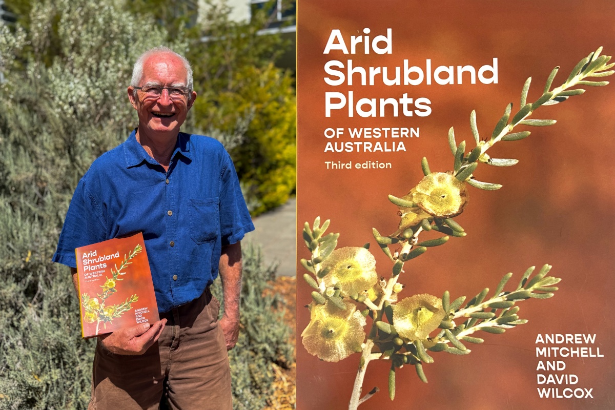
Andrew Mitchell and his book Arid Shrubland Plants of Western Australia, 3rd Edition. Photo - Sally Treasure/DBCA
A harsh environment
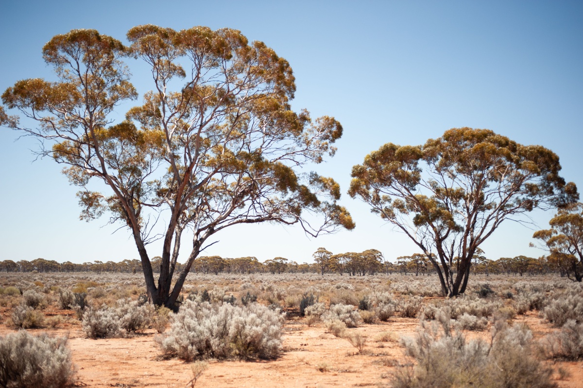
The Western Australian Wheatbelt forms the south-western boundary of the arid shrublands, following the 275-250mm rainfall isohyet, while the south-eastern boundary is formed by the Great Victoria and Gibson deserts. Rainfall in these deserts is unreliable and averages around 200mm, sufficient to support sparse spinifex and shrubs.
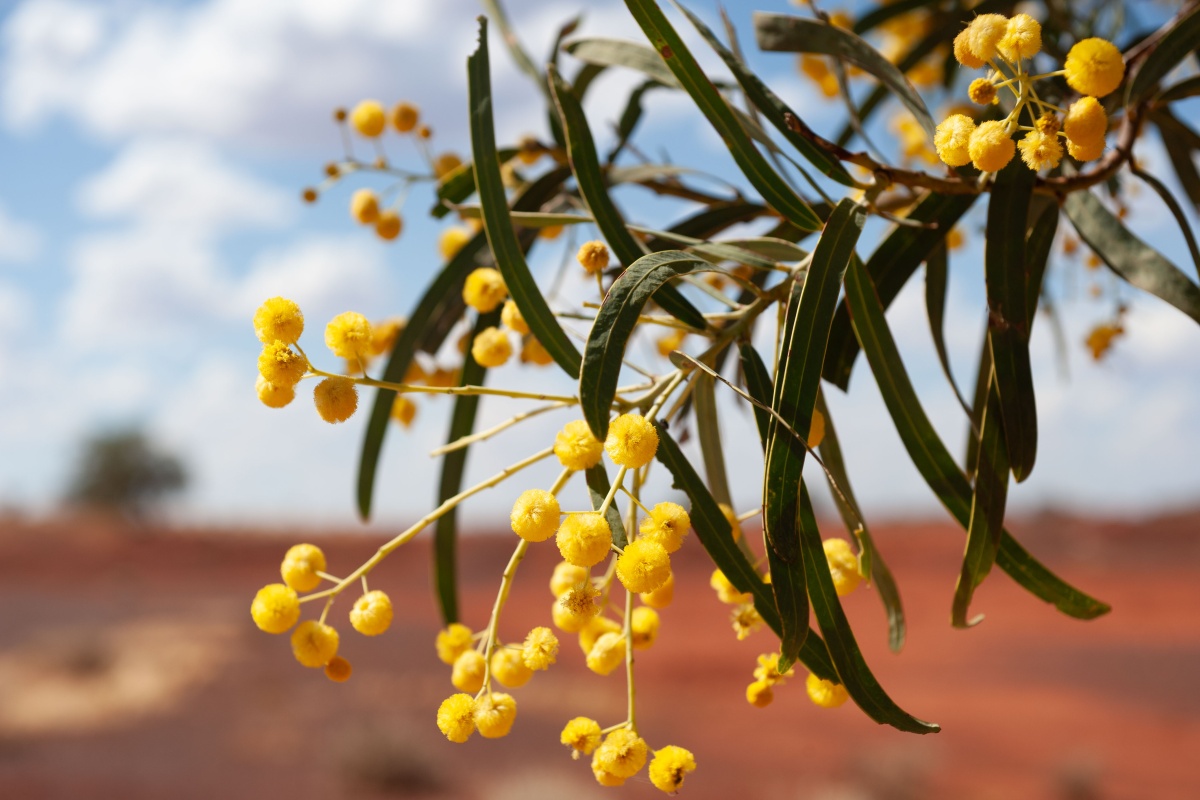
The northern boundary lies along the north side of the Fortescue River valley. Acacias are the dominant trees in this area as it is too dry for most gum trees, with mulgas and gidgees the most common. The rangelands to the north of the Fortescue River receive more regular summer rain and the vegetation is dominated by spinifex and grass that regularly carry fire.
A gidgee near Meekatharra providing a stunning floral display in November at a time when the landscape is generally sombre.
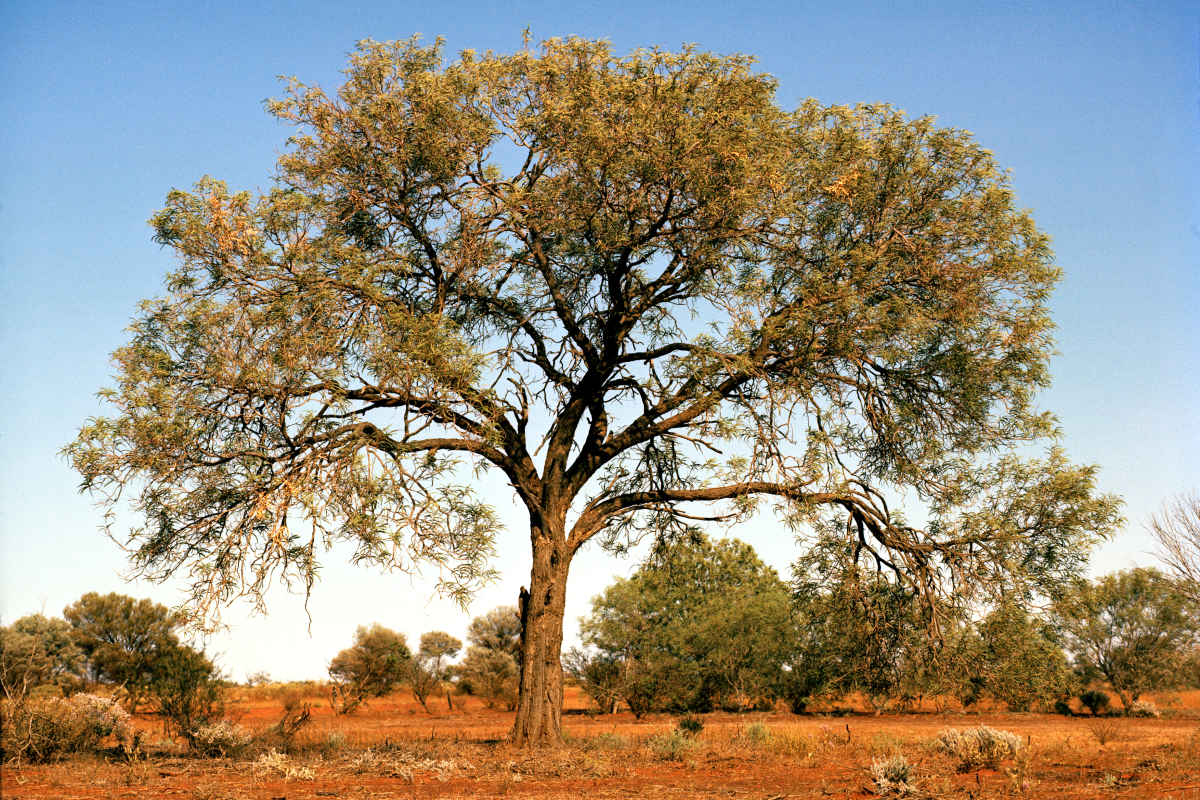
A gidgee near Cue. Wedge tail eagles often nest in the larger trees.
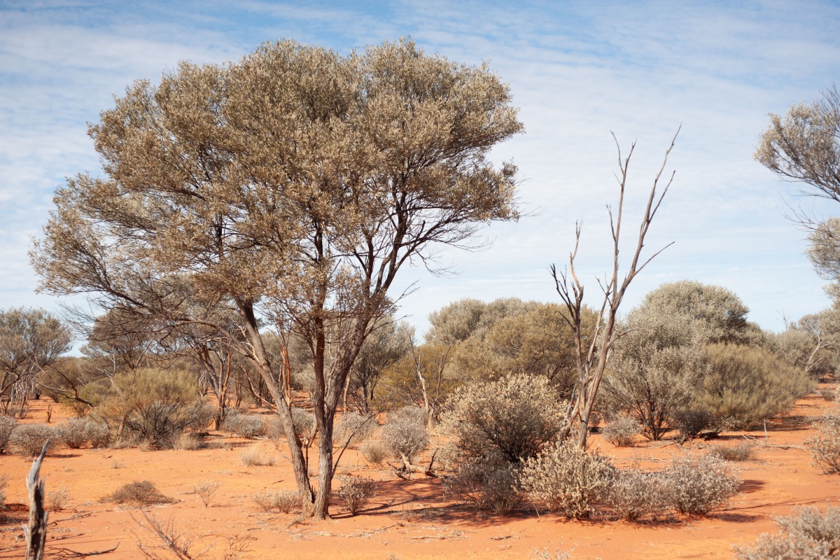
A mulga shrubland near Mt Magnet. Mulgas mostly grow in soils underlain by coffee rock (red-brown hardpan) that is rich in silica. These soils form flat plains that open up north of Cue where they support very sparse low shrubs in extremely shallow soils. Where the soils are deeper or are better watered, mulga grows in thickets.
South of Leonora, the coffee rock plains are replaced by deeply weathered rocks which form gently undulating plains supporting a variety of gum trees (Eucalyptus spp.) that form a parkland over shrublands of pearl bluebush (Maireana sedifolia) or saltbushes (Atriplex spp.). This area is the Great Western Woodlands and there is no relatively fresh underground water. It is mostly super saline; some more so than sea water.
Parkland of pearl bluebush (Maireana sedifolia) shrubland with a scattered overstorey of red morrel (Eucalyptus longicornis) east of Kalgoorlie.
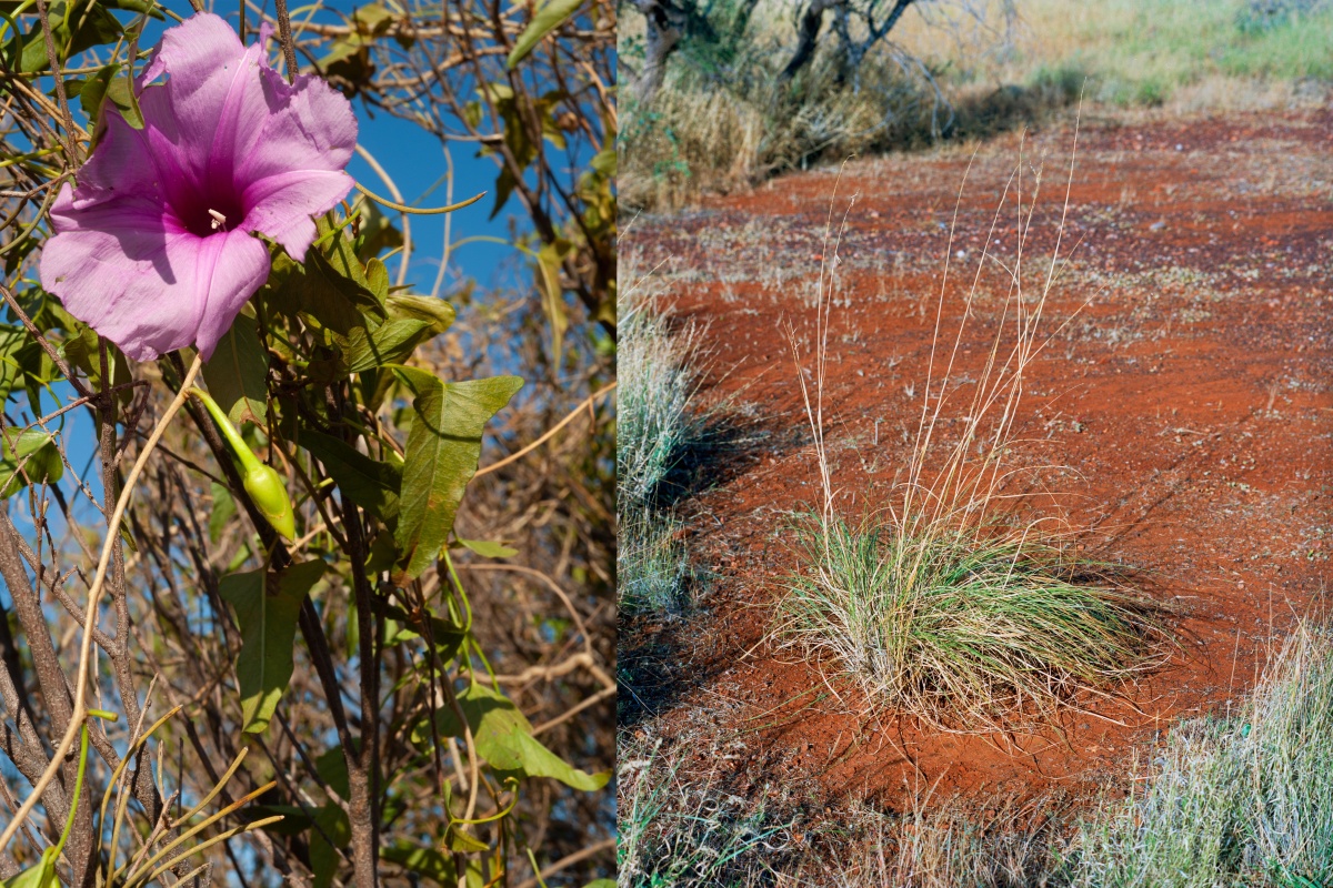
Left: Culyu or bush potato (Ipomoea calobra) has morning glory-type flowers and a large edible tuber that produces vines after rain. It grows in mulga thickets and the tubers are often a metre deep which are dug up, cooked and eaten by Traditional Owners. Right: Weeping grass or ribbon grass (Chrysopogon fallax) is a native perennial grass found north of Meekatharra. It’s called ribbon grass because if you try to pull it out of the ground, it cuts your hands to ribbons. It is a good forage and decreases under heavy continuous grazing.
Scorching summer temperatures and stunning wildflower displays
The climate of the arid shrublands is characterised by hot dry summers with temperatures sometimes reaching 47°C. Summer rain becomes more common and reliable in the north, while winter rainfall declines and is less reliable.
Temperatures gradually increase in the north. Winters in the northern shrublands are generally short and mild. However, in the south, winters are cold with regular frosts and maximum temperatures of 10°C are not uncommon. Winter rains are reasonably reliable and usually start in May or June, although consecutive years of drought are not uncommon.
The area is known for its stunning displays of annual wildflowers from August to September. These annuals only germinate if there are reasonably heavy rains—25mm plus over two days in May or June with some follow up is usually sufficient to produce carpets of flowers.
Climate change will reduce the reliability of the winter rains across the whole area while summer rainfall will likely increase both in intensity and volume.
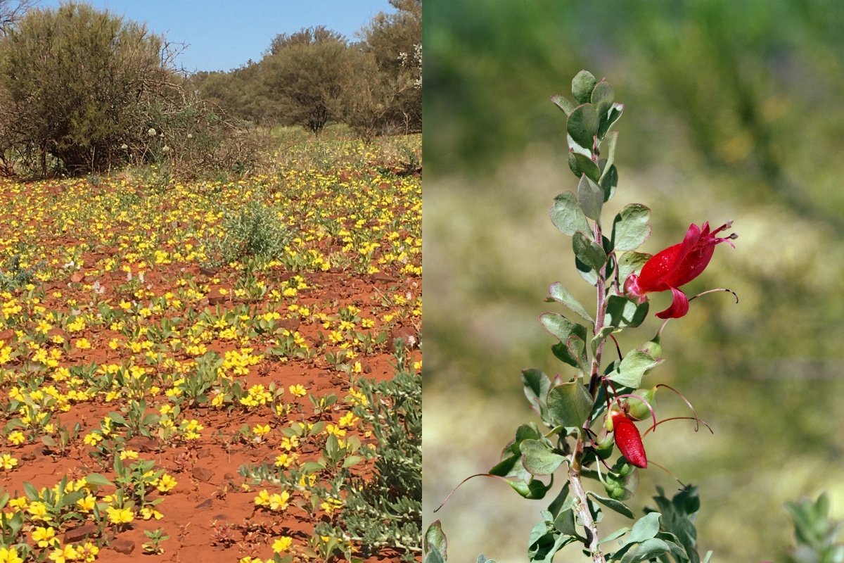
Left: Mat goodenia (Goodenia prostrata) near Kumarina. Right: Fuchsia bush (Eremophila maculata) is commonly planted in gardens in Western Australia. It grows in semi saline clays with saltbushes and bluebushes and is eaten by herbivores. It contains cyanide and hungry stock have been known to die if they eat too much on an empty stomach.
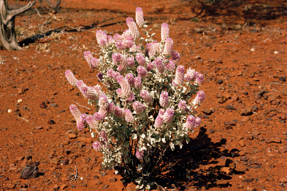
Royal mulla mulla (Ptilotus rotundifolius) is a shrub found from Cue to the southern Hamersley Range where it grows in skeletal soils. In the Hamersley Ranges it grows in areas where fires are not too frequent. Its flowers have a cloying sweet smell that can be overpowering in an enclosed space.
Building knowledge
Arid Shrubland Plants of Western Australia aims to assist those with an interest in arid lands, especially land managers, in plant identification and provide an understanding of the ecology of the arid shrublands. It covers a representative cross section of the major plant groups and describes in detail 314 species. There are perhaps 2000 species in the arid shrublands, depending on where you draw the line.
The book is organised into five sections—annuals, grasses, vines, shrubs and trees. There are 57 annual, 42 grass, six vine, 130 shrub and 81 tree species described. Each section is listed by botanical names and each species is given its common name; some have numerous common names while a few had to be given one.
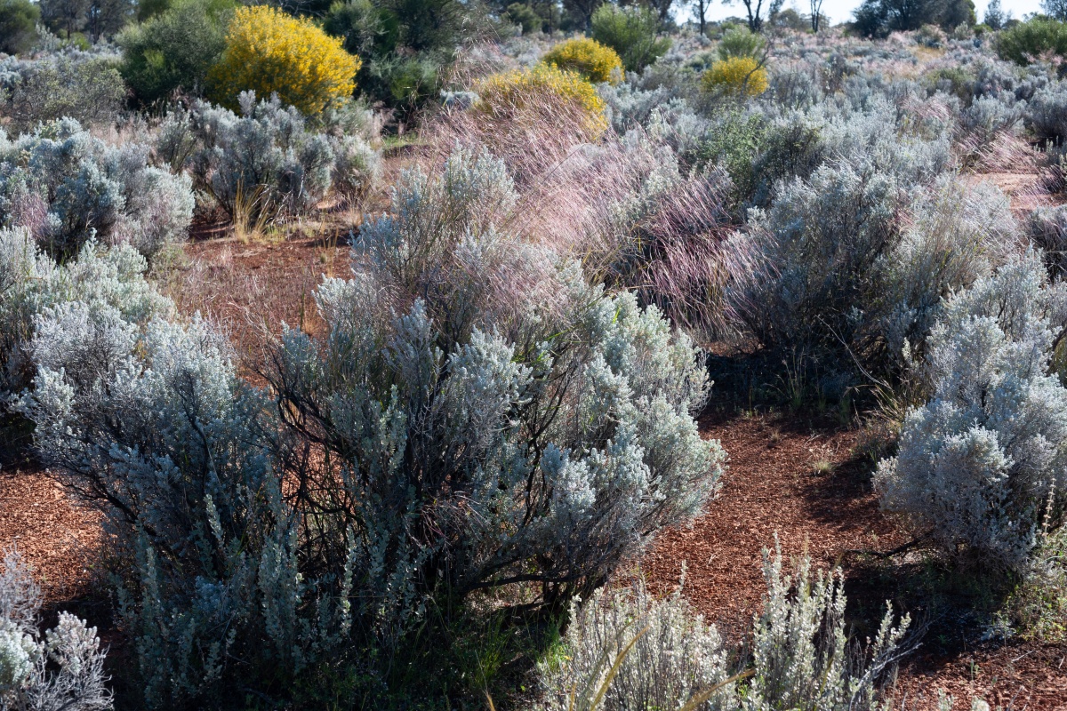
Pearl bluebush (Maireana sedifolia) in a good season with the purpley pink seed heads of silver speargrass (Austrostipa elegantissima) poking through the tops of each shrub near Coolgardie.
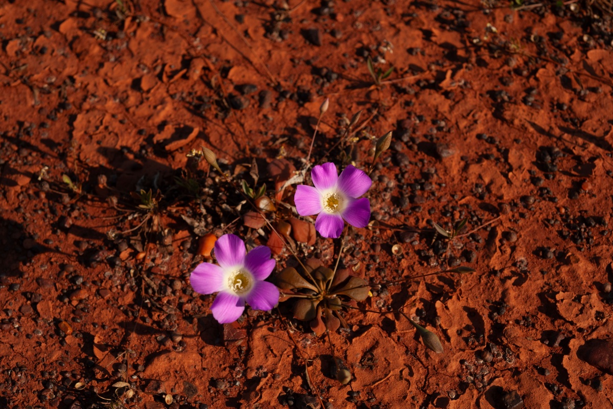
Calandrinia schistorhiza
Most perennial species have a close-up and an in-situ image to allow identification. The close-up image is usually of a diagnostically important part, such as a flower or seed. The in-situ image displays the plant’s shape in habitat, as seen from about 30m. A map is provided of each species distribution; thanks to DBCA Florabase records and DPIRD’s GIS specially prepared map base. DPIRD have supported the book to ensure its publication.
For each species, a general description is given in common language, giving the reader a point of reference for the images that are not scaled. Habitats are described in terms most readers will understand. The species forage value is described in terms of whether herbivores eat it and when, and its rangeland indicator value is summarised in terms of whether it decreases or increases under grazing. The species may have no rangeland indicator value and is not eaten but is an important habitat indicator. The book describes in common terms how a species can be distinguished from its near relatives.
Species uses are given; they may have value to Traditional Owners and other Australians alike. Mulga has multiple uses from edible seeds to fence posts and weaponry. Some, such as currant bush or maroon bush (Scaevola spinescens), have medicinal uses. References are cited to those that the author knows about.