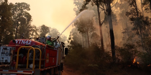
A buffer burn at Skeleton Rock. Photo - DBCA
The Parks and Wildlife Service Bushfire Risk Management Framework sets out how fuel hazards are managed on public lands to control bushfire risk across Western Australia (WA). The framework acknowledges the diversity of WA’s fire environments through bushfire risk management zones and fire management areas, and defines acceptable levels of bushfire risk, recognising that risk cannot be eliminated but can be reduced through targeted fuel management.
It identifies fuel management - particularly prescribed burning - as the department’s most effective means of reducing bushfire risk and defines indicators that demonstrate when fuel has been managed to meaningfully reduce bushfire risk under severe fire weather conditions.
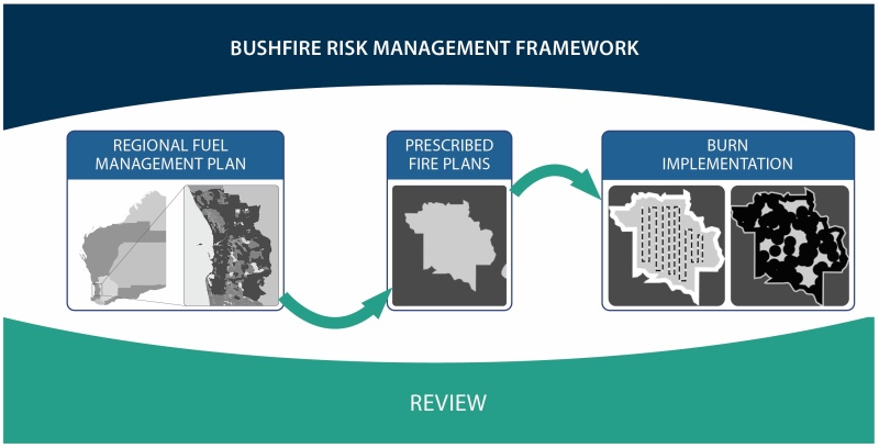
The Regional Fuel Management Plans assess bushfire risk to people, communities, infrastructure and the natural environment. The plans and overarching framework are based on the principle that managing the fuel available to bushfires is the most effective and efficient way to reduce the impact.
Key components of fuel management plans
Together, the department’s RFMP and overarching framework ensure a consistent approach to determining risk profiles, acceptable levels of risk and required strategic fuel management processes.
The framework and regional fuel management plans support the department’s regional on-ground works programs by:
- identifying assets within the bushfire risk management zones
- assessing the exposure and resilience of assets to bushfire risk
- mapping fire management areas based on asset and fuel distribution
- translating the framework’s indicators of acceptable risk into prioritised regional targets for fuel management
- providing measures by which the effectiveness of a region’s fuel management activities may be assessed.
The framework and subsequent regional fuel management plans aim to complement and assist bushfire risk management on neighbouring lands not managed by the department.
Bushfire Risk Management Framework:
Find the plan that links to your location - Map of DBCA’s Parks and Wildlife regions
Use the map to find your region of interest and download the overarching Bushfire Risk Management Framework and Regional Fuel Management Plans.