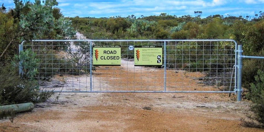
Hygiene gates. Photo by Greg Freebury/DBCA
As human activities often involve the intentional or unintentional disturbance and transport of soil and plant material, they have the potential to spread dieback further and faster than any other means of spread. Consequently, controlling or limiting human access to uninfested areas is a very effective way to protect them from dieback. The department manages several kinds of areas designated for special protection including:
- Disease Risk Areas
- Priority Protection Areas
- Other management zones
Access to these areas may be controlled through:
- temporary road closures during wet weather when there is a greater likelihood that carriers will pick and transport potentially infested soil
- restricted access for management purposes only and/or
- a requirement for a permit to enter
For areas of controlled access, requests for information and permit applications can be made through the local or district DBCA office. In these areas always read and adhere to signs and always practice good hygiene.
Disease Risk Areas
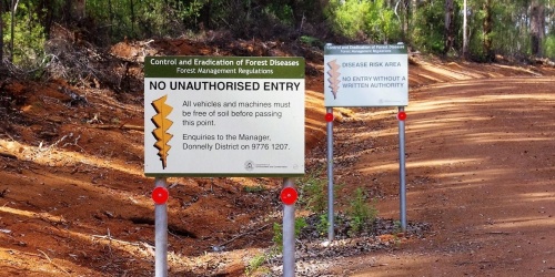
The occurrence of Disease Risk Areas within the Swan, South-West and Warren regions are shown shaded in blue in the map below. Disease Risk Areas (DRAs) are signposted on-ground to let visitors know they are entering a DRA. To access and bring a 'potential carrier' (anything capable of carrying and transmitting forest disease) into a DRA requires written authority in the form of a permit.
Disease Risk Areas are provided for in the Conservation and Land Management Act 1984 and associated Forest Management Regulations 1993. DRA entry permits have been developed in compliance with the legislation. Entering a DRA without possession of a valid permit or in breach of permit conditions can attract significant penalties.
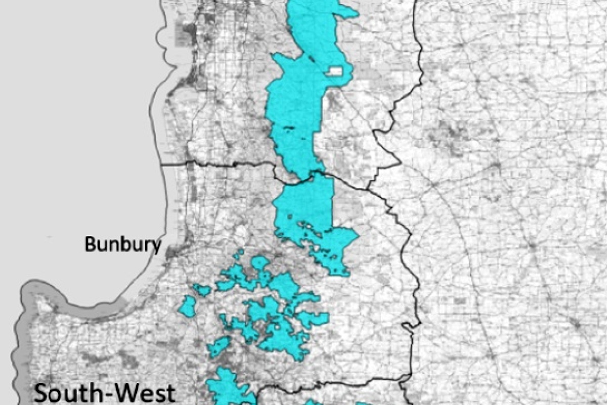
Map of the south-west of WA showing the Disease Risk Areas (blue). Image - DBCA
Priority Protection Areas
Priority Protection Areas (PPAs) are areas within the 'vulnerable zone' that have been identified as high priorities for action and investment to protection from the spread and impact of Phytophthora dieback. PPAs have been identified across a range of land tenures, however, most occur on DBCA land. A range of access control measures have been used in conjunction with other dieback management tools in PPAs across the south-west. More information can be found on the Project Dieback page.
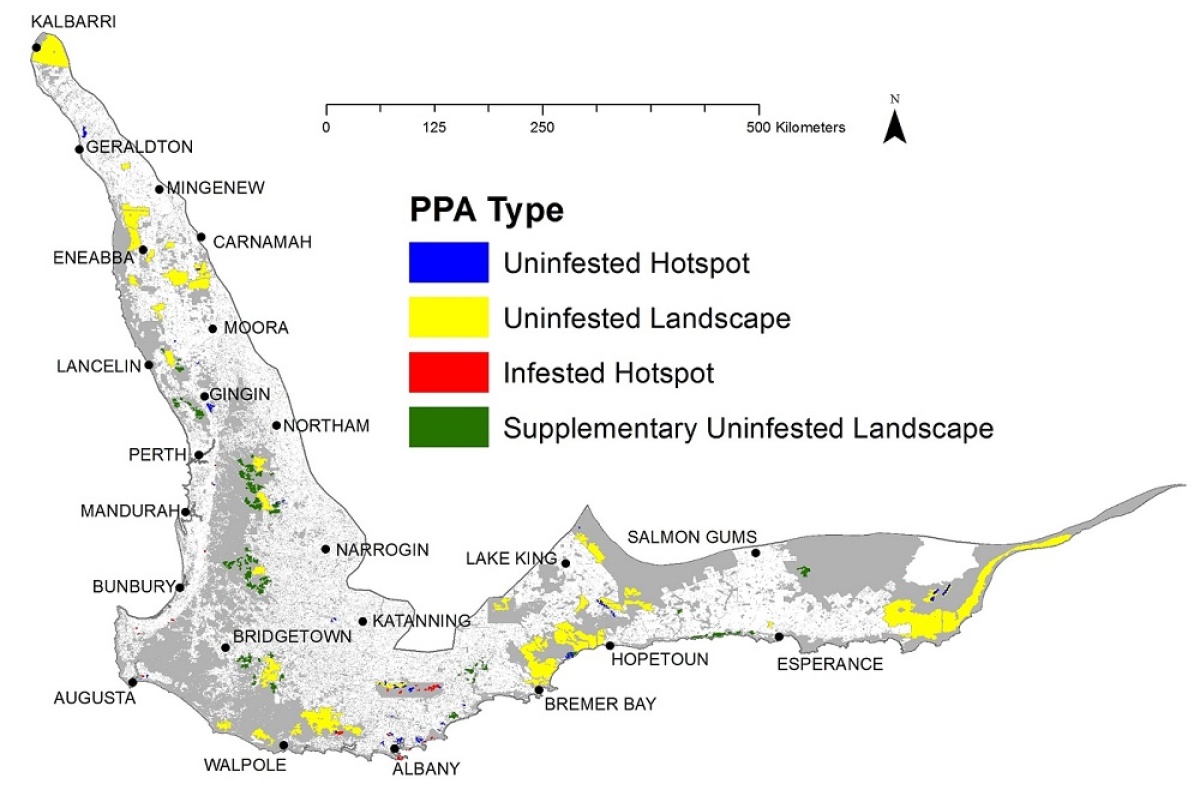
Map of the Priority Protection Areas identified under Project Dieback. Image - South Coast NRM.
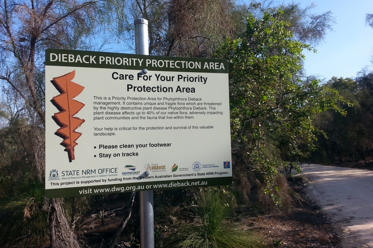
Priority Protection Area signage. Photo - Kat Sambrooks/DBCA
Other management zones
Some DBCA parks and reserves also use zoning to identify areas in need of special conservation, e.g. 'Wilderness Conservation Zones' and 'Special Conservation Zones'. Access control may be used within these zones to protect their special values from the spread and impact of Phytophthora dieback as well as other key threats. The types and locations of the zones, as well as any, assess restrictions are likely to be identified in the 'area management plan' for the park or reserve encompassing the zone/s. Follow the link to see a current list of approved management plans.