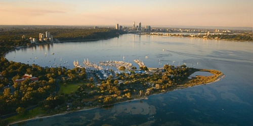
Perth City Skyline. Photo by Tourism Western Australia
Managing development
Facilitating appropriate land use and development in and around the Swan Canning Development Control Area is a key responsibility of DBCA and the Swan River Trust.
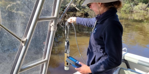
DBCA ensures that land use and developments protect and enhance the ecological health, cultural significance, community benefits, amenity and heritage values of the Swan Canning river system. It also works in partnership with local governments and the Department of Planning, Lands and Heritage to provide advice on strategic planning proposals likely to impact on water quality and water quantity in the Swan Canning river system. Advice is based upon the application of water sensitive design (WSD) that integrates the urban water cycle (including stormwater, groundwater and wastewater management and water supply) into the planning and design of urban environments to provide multiple benefits to the environment and the community.
DBCA provides funding support to the New WAter Ways program, which builds the WSD capacity of government and industry practitioners in Western Australia to improve the delivery of urban water management and water sensitive cities. DBCA is an active member of the New WAter Ways partnership, which includes the Department of Planning, Lands and Heritage, Department of Water and Environmental Regulation, Water Corporation, Western Australian Local Government Association and Urban Development Institute of Australia WA. DBCA also works in partnership with other agencies, local governments, industry associations and universities to implement a water sensitive Perth and Peel through membership of the Water Sensitive Transition Network and the delivery of actions in the State Government’s Kep Katitjin – Gabi Kaadadjan: Waterwise Action Plan.
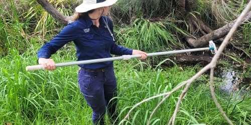
DBCA assesses development proposals within, abutting or affecting the Swan Canning Development Control Area and provides advice to ensure projects do not adversely affect the river system, while meeting community expectations.
Development pressure
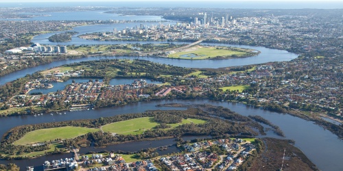
Perth is undergoing rapid growth, with the population doubling during the past 30 years and expected to reach 3.5 million people by 2050. Urban, industrial and rural developments throughout the catchment are placing increased pressures on the Swan Canning river system.
Without proper land use planning and development processes, increased sediment transport and mobilisation of nutrients and other contaminants into the Swan Canning river system can occur. With a drying climate, there is also an increased need to maintain flows to the river system as land uses change.
Developments should also be built on the principle of enhancing public spaces along the waterfront to allow the community to continue to enjoy the highly regarded amenity of the rivers.
There is a need to balance development with the strong community desire to protect and enhance the riverine environment, protect its landscape amenity and maintain and improve public access to the rivers for a range of recreation activities.
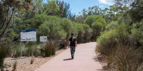
Kent Street Weir
The Kent Street Weir is located on the Canning River in Cannington, next to the Canning River Eco Education Centre.
The weir was first constructed from sand bags in 1911 to stop salt water affecting agricultural land upstream. A more permanent weir was completed in 1927. It has since undergone many changes to its design and function with its most recent update in 1989.
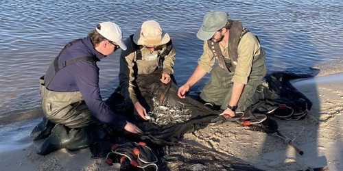
Since the completion of the permanent weir, a ‘weir pool’ has formed in the river channel upstream of the weir. This pool extends approximately 5km upstream, maintaining a relatively constant water level through the drier months. Because the pool’s water is usually fresh, the river environment has become dominated by freshwater-dependent flora and fauna, including native fish such as the western pygmy perch and western minnow, reptiles such as the oblong tortoise, crayfish such as gilgies and marron, in-river vegetation including Potamogeton species, and terrestrial vegetation like the flooded gum (Eucalyptus rudis) and freshwater paperbark (Melaleuca rhaphiophylla).
The Kent Street Weir is made from 17 concrete bays, each containing four removable stop boards. The boards are typically removed once there has been enough rainfall to push salt water downstream - usually in June or July - and replaced when river flows are reduced to stop salt water moving back into the weir pool - usually in October or November. This annual cycle of stop board removal and replacement allows annual flushing of the system, and facilitates the movement of fish and other animals upstream of the weir during winter and spring.
In 2010, for the first time on record, the boards were not removed. A dry year producing the lowest stream flows on record meant winter flows in the Canning River were not sufficient to allow their removal. In recent years, stream flows have tended to occur later in the season, meaning the weir boards are often not removed until July or August, and are typically replaced earlier to ensure that salt water is not ‘trapped’ behind the weir over the summer months.
While the principle aim of the modern day Kent Street Weir is to stop salt water from moving upstream, the primary justification has changed from protection of farm land, to protection of the freshwater-dependent flora and fauna now present in this stretch of the river.
The weir also provides footbridge passage across the river and allows recreational activities like kayaking and fishing during the summer months by maintaining water levels in the river upstream of the weir.
Recent inspections of the weir pylons have indicated structural weaknesses that need to be addressed. Refurbishments to the weir by the Department of Water, with assistance from Parks and Wildlife and City of Canning, are likely to occur in 2016-17. This refurbishment will extend the life of the weir by at least 50 years and address issues such as increasing water levels, increased public access and ensuring the structure remains safe.
Risks to the environment above the weir
The environmental values, and ultimately the social and economic values, upstream of the weir are at risk from three principal threats.
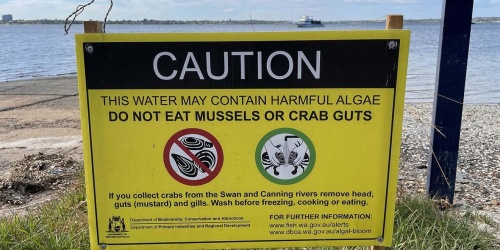
- Salt intrusion. The estuary downstream of the Kent Street Weir is saline, and occasional tide and storm surges have caused downstream water levels to exceed the height of the weir structure. This results in large volumes of salt water entering the weir pool, which can adversely impact native flora and fauna that is dependent on fresh water. Salt water is denser and therefore heavier than freshwater, and can sit at the bottom of the weir pool. This can reduce Parks and Wildlife’s ability to oxygenate the system, and increase the amount of nutrients, in particular phosphorus, being released from sediments.
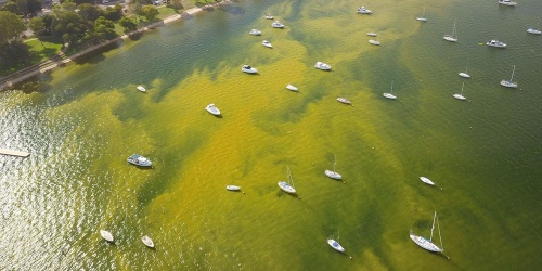
- Nutrient enrichment/algal blooms. Large amounts of nutrients, predominantly nitrogen and phosphorus, enter the Canning River from its catchments, particularly after heavy rain. Much of this is available for algal growth, and under the right flow and weather conditions can lead to algal blooms. The availability of these nutrients is also increased under anoxic, or no oxygen, conditions that often occur after salt intrusion into the weir pool.
- Deoxygenation. Like most impounded water bodies, the Kent Street Weir pool is susceptible to low oxygen levels as a result of minimal water movement. This can affect the survival of the fauna in the weir pool, and interrupt natural processes like organic matter breakdown and nutrient cycling.
Management
The risks of nutrient enrichment, algal blooms and deoxygenation are managed through a range of initiatives.
- Strategic timing, based on monitoring data, for removal and replacement of stop boards to flush the weir pool and allow movement of fish into upstream habitat zones
- a long-term oxygenation program on the Canning River
- the occasional addition of Phoslock, a modified clay that can reduce dissolved phosphorus available in targeted areas of the river
- catchment activities designed to reduce nutrients entering the system from the catchment, including the Drainage and Nutrient Intervention Program and local water quality improvement plans (WQIPs)
Environmental flows
Vegetation and fauna in the Riverpark survive in a delicate balance with the water regime in the Swan and Canning rivers, their tributaries and their catchments. Significant change to water volumes, flow rates, water quality or the timing of water delivery can have a negative impact on the health of rivers, streams, pools and wetlands.
Environmental water requirements (EWR), commonly referred to as “environmental flows”, describe the water regime required to maintain the ecological values of water-dependent ecosystems at a low level of risk. Environmental water provisions (EWP) describes a water release regime provided to improve or maintain these ecological values. EWPs are delivered, monitored and managed in some rivers according to water allocation plans developed by the Department of Water and Environmental Regulation in consultation with a broad stakeholder group, including DBCA.
Impacts of dams and other impoundments
The flows in five of the Swan Canning river system’s tributaries (Canning River, Wungong River, Helena River, Bickley Brook and Churchman Brook) are controlled to meet domestic water supply needs. Impoundments, such as dams or reservoirs constructed for public water supply, reduce the total volume of water flowing in the waterways downstream, impacting the seasonality, duration, extent and variability of flow in waterways. This can result in a disconnection between the waterway and its floodplain and wetlands. Impoundments can also disrupt the continuity of waterways by reducing the flow of organic material and sediments downstream, and by creating a barrier to the movement of fish and other fauna.
These factors can combine to reduce the distribution and abundance of birds, fish, riparian and aquatic vegetation, frogs and other aquatic organisms. Reduced flows can also lead to degraded water quality as temperatures increase and dissolved oxygen levels decrease, which can affect fish and invertebrate survival. Changing the frequency and extent of flows can cause changes to waterway geomorphology through bank slumping, sedimentation and colonisation by exotic and terrestrial vegetation that would not become established in an unaltered waterway.
DBCA is addressing the need for greater environmental flows to be delivered to the major tributaries of the Swan and Canning rivers through its environmental flows program and supports the delivery of environmental water releases to the Canning, Helena and Wungong rivers.
Long-term stream flow trends
There has been a long-term trend in Western Australia toward reduced stream flows, independent of the effect of impoundments. Reductions in freshwater flows to the Swan and Canning rivers have combined with the now permanent opening to the ocean at Fremantle to markedly alter the hydrodynamics, geomorphology and ecology of the estuary.
Climate change is expected to further reduce freshwater flows to the estuary, and this will cause saline water from the ocean to penetrate further upstream. This will reduce habitat for freshwater fauna and flora and may affect breeding cycles of fish and other fauna that rely on consistent patterns of freshwater flow in the estuary to stimulate migration and reproduction.
The future
DBCA will work with other water management agencies to examine the feasibility of delivering environmental flows to other sections of waterways downstream of impoundments. In the short-term, the focus will be on the Canning and Helena rivers.
Drainage
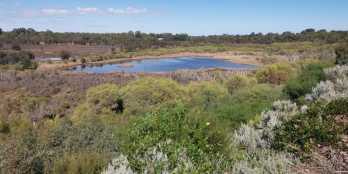
The Perth metropolitan area lies on the Swan Coastal Plain, a relatively flat sedimentary zone located between the Darling Scarp to the east and the Indian Ocean to the west. This zone consists of mostly sandy soils with limited nutrient holding capacity and a shallow groundwater table expressed as ephemeral wetlands.
More than 80% of the wetlands have been cleared and/or drained for urban, industrial and agricultural purposes, and fertilisers and other chemicals have been applied to increase soil productivity. These pollutants, along with those contributed by other land uses within the catchment, leach through the soil into groundwater and enter the river system through groundwater discharge and overland flow.
Perth’s drainage network was constructed to convey floodwaters and to lower the shallow groundwater table through open drainage channels, drainage pipes and basins. Unless the drainage water is treated (e.g. via constructed wetlands), drainage systems convey excessive nutrients and other pollutants to the river system.
Under natural conditions, most rain falling on a catchment soaks into the soil, tops up groundwater aquifers, is used by vegetation, evaporates, or travels over or under the ground towards streams, rivers, wetlands, reservoirs or the ocean. Urban development creates impervious surfaces such as roofs, roads and pavements. This means that most rainfall no longer infiltrates where it falls.
Many urban drainage lines and basins/sumps were once natural streams and wetlands, but these have been highly modified to cope with the increased runoff caused by urban development.
In rural areas of the Swan Canning Catchment, modified creek lines often still exist. However, the surrounding land and foreshore vegetation is often degraded, which causes increased runoff, nutrients and sediment loads to be delivered to the river system.
The urban drainage system includes:
- open drainage channels - mostly unlined, linear, trapezoidal shaped and often excavated into the groundwater table, which are very efficient at conveying stormwater runoff to the receiving environment
- closed pipes and drainage structures - usually constructed of concrete which are very efficient at conveying stormwater runoff to the receiving environment, with no or little water quality improvement (other than gross pollutant removal)
- basins and sumps - allow high stormwater flows to be detained or retained (infiltrated) in the catchment, reducing the risk of flooding roads and properties
- streams and wetlands – these are part of the urban drainage system as they receive and convey stormwater flows
- roads and verges – these are part of the urban drainage system as they convey stormwater flows
- water sensitive design stormwater management systems - including tree pits, raingardens, biofilters, permeable paving, constructed wetlands, vegetated swales and living streams, which improve water quality, biodiversity and amenity and mimic natural hydrology/water balance.
The application of water sensitive design (WSD) incorporates water cycle management in the urban environment so that environmental and social values are protected and enhanced. This approach allows stormwater runoff generated by smaller rainfall events to be retained in the catchment and uses vegetation and soil to filter stormwater, which improves water quality and enhances habitats and amenity.
The Department of Water and Environmental Regulation’s Stormwater Management Manual for Western Australia, developed in partnership with the Swan River Trust (now DBCA) and other stakeholders, advocates the use of WSD, providing high-level policies, planning principles and practical on-ground best practice advice to manage stormwater.
DBCA, through its River Health Improvement Program, is working with partner organisations to remove excess nutrients and other contaminants from drains and tributaries in catchments that contribute high nutrient loads to the Swan Canning river system.
Acid sulphate soils
Acid sulphate soils naturally occur in Western Australia, including the Swan Canning Catchment, and are harmless when left in a waterlogged, undisturbed environment.
However, when exposed to air through drainage or excavation, iron sulphides in the soil react with oxygen and water to produce iron compounds and sulphuric acid. This acid can release other substances, including heavy metals, from the soil and into the surrounding environment, groundwater and waterways. Once mobilised, they can kill vegetation and fish, damage fisheries and aquaculture industries, harm tourist resources such as fishing grounds, swimming areas and recreational waterways, and damage infrastructure including corroding concrete and steel pipes, building foundations and bridges.
Activities with the potential to disturb acid sulphate soils must be managed carefully to avoid serious environmental harm. Proposed developments often require acid sulphate soil testing, and where appropriate, management plans to prevent potential damage to the environment.
The Department of Water and Environmental Regulation has produced a series of fact sheets and guidelines to assist with the identification, investigation and management of acid sulphate soils in Western Australia